Weather and Road Condition Update
- Feb 3
- 2 min read


February 3, 2026 at 14:00
From Beaufort County Emergency Services:
Our office would like to provide you all with a brief update on our county’s efforts to recover from our recent winter storm, and share information related to our forecasted weather pattern for the next 10 to 14 days.
Current Recovery Efforts
Road Clearing
• DOT and municipal staff are diligently working to clear our roadways of accumulated snow and ice. Our primary roads (Hwy 264, 17, 33, 32, 92 etc.) are mostly clear with exceptions of shaded areas. While efforts to transition to our first-tier secondary roads are underway, many less travelled secondary roads, neighborhood side streets, etc., remain snow covered.
• Please continue to drive with caution on our snow-covered roads and beware of frozen surfaces and black ice during the overnight and early morning hours.
Utilities
• While we were blessed not to have experienced power and other infrastructure failures with this last storm, our recent round of cold weather has placed a strain on our electric grid, with some electric providers requesting that users conserve energy whenever possible. Please continue to monitor messages from your local electric providers and follow their advice as much as possible.
Weather Information
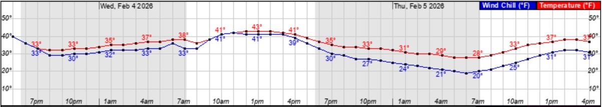
Today & Wednesday
• We are expected to remain near or above freezing through midnight Wednesday, which should help to melt our accumulated snow and ice. (Especially with today’s sunshine and daytime highs in the low 40’s.) We are expecting cloudy conditions tomorrow, and rain likely after 1pm, with most areas receiving between ? and ? of an inch. However, our rain will likely be mixed with periods of freezing rain and snow between 10pm Wednesday night and noon Thursday as our temperatures will be below or near freezing. Fortunately, this mixed precipitation should not result in significant accumulations, with most areas receiving less than a 1/8th of an inch during this time.
Thursday & Friday
• Thursday (2/5)
• Forecasted high of 38 degrees, with above freezing temps between 9am and 6pm.
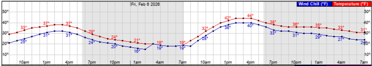
Friday (2/6)
• Forecasted high of 44 degrees, with above freezing temps between 10am and 7pm Saturday.
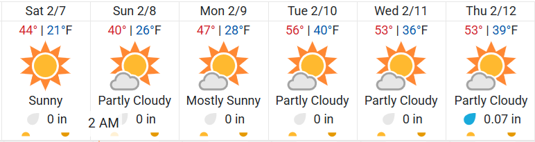
Forecast Beyond Saturday (2/7)
• Saturday and into next week look to be sunny, with daytime highs well above freezing.
• While there are some long-range forecast models that are indicating another round of cold temperatures around the 15th of February, it is too early for details. We will continue to pass along updated information as we receive it.